Koya-zaka Slope
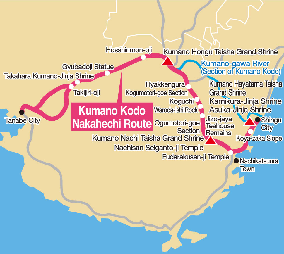
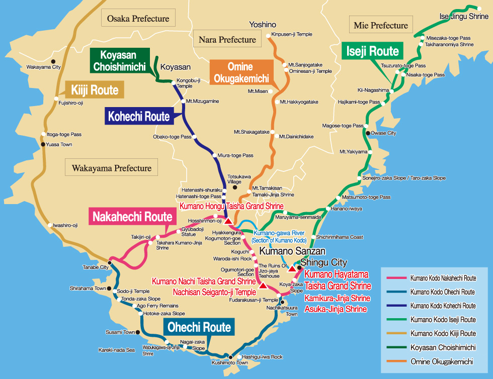
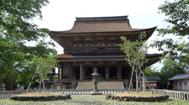
The pilgrimage routes to the Kumano Sanzan (Kumano Hayatama Taisha Grand Shrine, Kumano Hongu Taisha Grand Shrine, and Kumano Nachi Taisha Grand Shrine) are collectively known as the Kumano Kodo. The Kumano Kodo consists of six pilgrimage routes: the Iseji route, which leads from Ise-Jingu shrine to the Kumano Sanzan; the Kiiji route, which connects Kyoto and Osaka to Kumano; the Nakahechi route, which extends east from Tanabe City; the Kohechi route, which connects Koyasan to Kumano Hongu Taisha Grand Shrine; the Omine Okugakemichi route, which connects Yoshino and Kumano to the Kumano Sanzan; and the Ohechi route, which runs along the coastline from Tanabe City. Four parts of the Kumano Kodo Nakahechi route pass through Shingu.
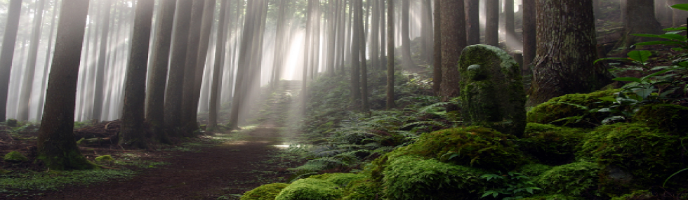
This pilgrimage route proceeds east from Tanabe in the western part of Wakayama Prefecture to the Kii mountain range, heading toward the Kumano Sanzan. It was the official route of the Kumano Koko, a pilgrimage made by the retired emperor and aristocrats during the 9th-12th centuries. On the way, there is a shrine called Kujuku Oji, where it is said that long ago many pilgrims stopped to take a break and write poems. Four pilgrimage routes pass through Shingu: the mountain route, comprised of the Ogumotori-goe section and the Kogumotori-goe section; the coastal route called the Koya-zaka Slope; and the route by boat down the Kumano-gawa River.
Hyakkengura
Tsuboyu Onsen

Kumano River Boat Tour
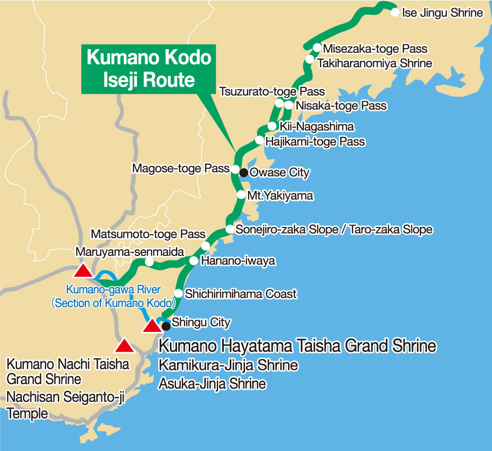
The Iseiji pilgrimage route is approximately 170 km long, leading from Ise-Jingu Shrine to the Kumano Sanzan. During the Edo period, pilgrims often used this route when visiting the 33 temples in the Kansai area, known as the Kansai 33 Kannon Pilgrimage, after worshipping at Ise-Jingu Shrine. Two of these pilgrimage trails pass through Shingu. The first is the Hamakaido (south) route, which starts from the Shichirimihama roadside station and travels along the coast. The other is the Hongu-do route, which leads into the mountains from the Shiko bus stop, crosses the Banze-toge Pass and merges with the Kogumotori-goe section of the trail.
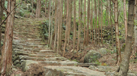
Stone path of Matsumoto-toge Pass
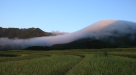
Fuden-oroshi, a phenomena where the difference in air pressure between the coastal and in-land side of the mountains, causing a thick fog to pour down the slopes and surround Oroshi Village.
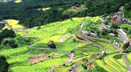
Maruyama Senmaida
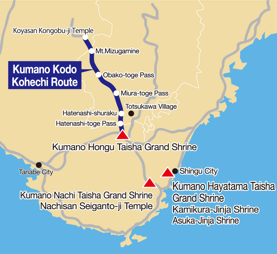
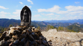
The Kohechi route is the shortest pilgrimage trail, connecting two sacred sites, Koyasan, the historic center of Shingon Buddhism, and Kumano Hongu Taisha Grand Shrine. The trail is about 70 km long, and traverses three passes that are each over 1,000 meters in elevation; the Obako-toge pass, the Miura-toge pass, and the Hatenashi-toge pass. This route is very rugged and steep, but the path is made clear by the many ancient signposts, known as cho-ishi, dotted along the way. There are also thirty-three stone Kannon statues lining the Hatenashi-toge pass to guide climbers and take away their fatigue.
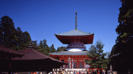
Konpon Daito Pagoda located in Koyasan, housing a rare three dimensional mandala comprised of various paintings and statues.
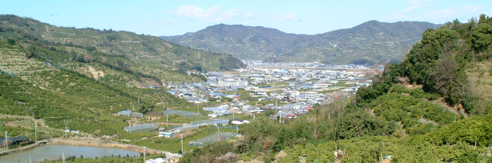
View from Mt. Mizugamine
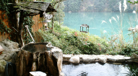
Totsukawa Onsen
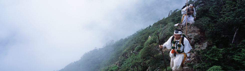
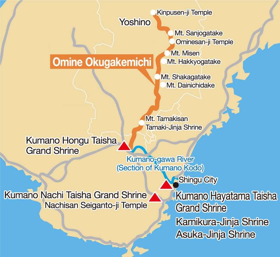
Running through the center of the Kii Peninsula, the Omine Okugakemichi connects the northern end of the Omine mountains, Mt. Yoshino, through to the southern end of the range, Kumano. This is mountain path was used as the route to reach the training grounds for ascetic monks since 9th Century. Consequently, it is a training route with many difficulties and is not a mountain hiking trail recommended for casual or general hikers. The total distance is about 170 km. A part of the route passes through the prefectural boundary between the northern end of the Wakayama and Nara prefectures.
Kimpusen-ji temple
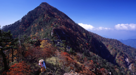
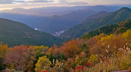
Autumn leaves of Mt. Shakagatake
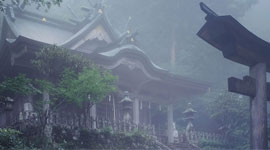
Tamaki-jinja Shrine
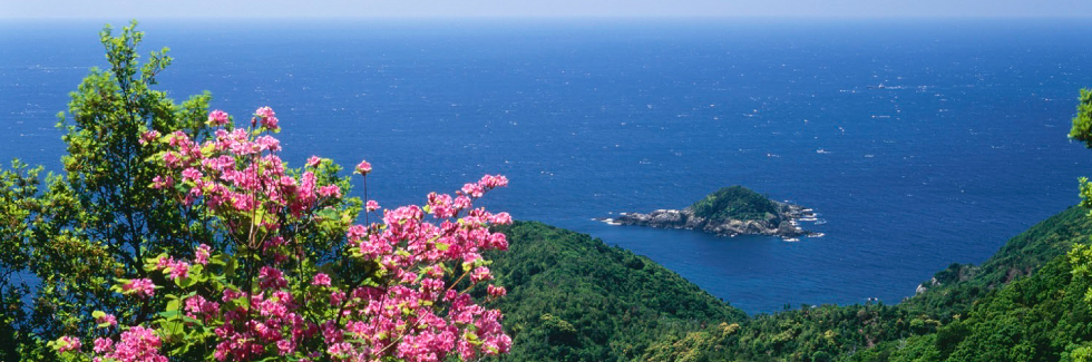
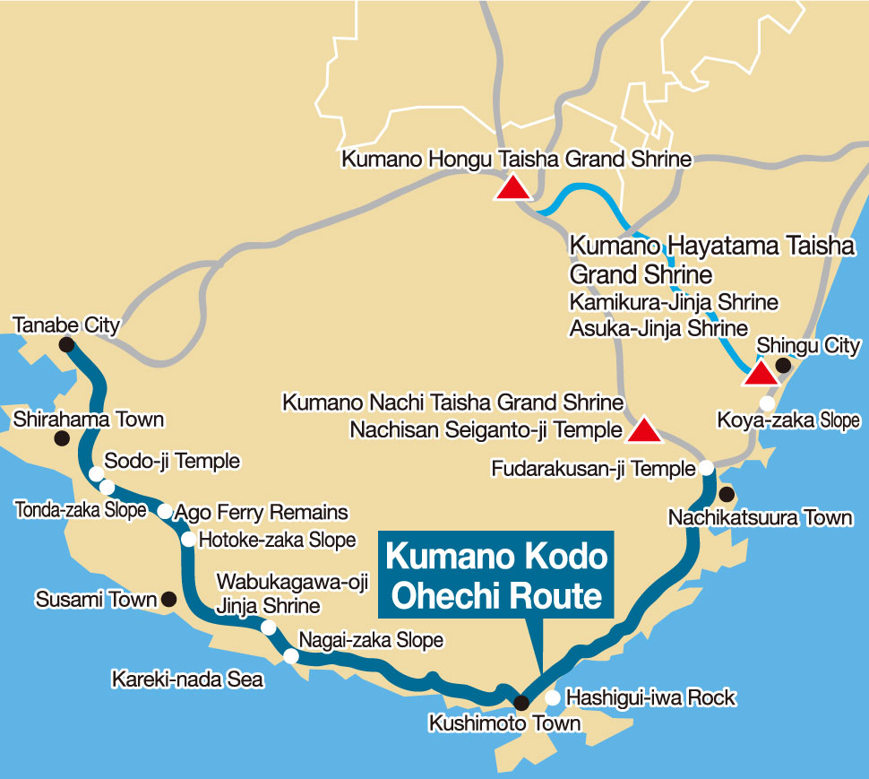
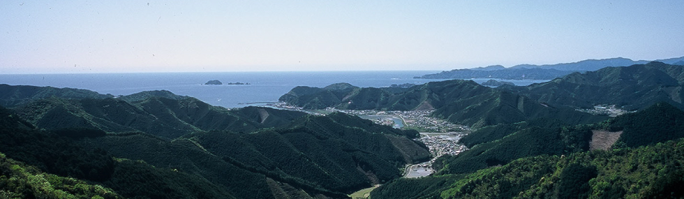
The Ohechi route is the trail that was taken by ordinary people, including many writers and artists, who had some time to spare and wanted to enjoy the views of the Kareki-nada and Kumano-nada seas. The total distance is about 92 km from Tanabe in western Wakayama Prefecture to Hamanomiya, Nachikatsuura in the southeast. In the early Edo period, milestones were built along this route by the feudal government of the area, the Kishu Han Domain. The Ohechi route has many steep slopes and hills, with scenic vistas and sights that have stayed the same from ancient times.
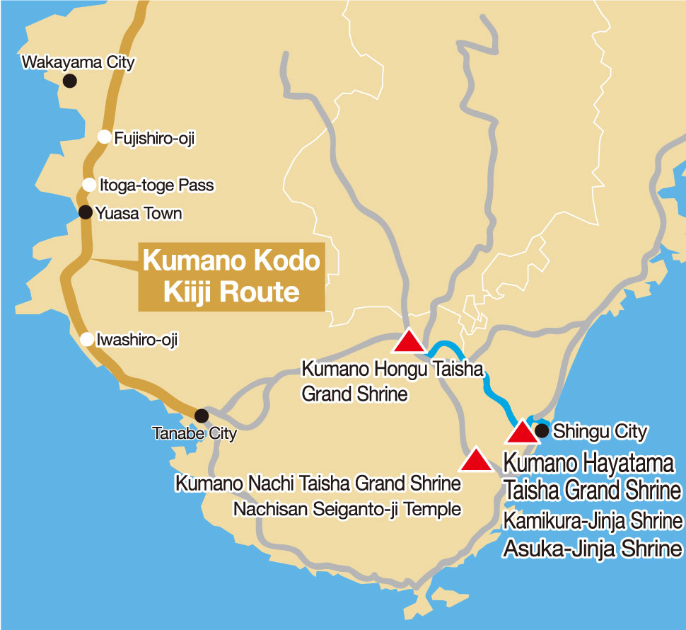
The Kiiji route goes from Osaka to Tanabe, in the western part of Wakayama Prefecture. It is the pilgrimage trail historically used by emperors walking from the cities of Asuka and Nara, where the courts resided, even before the Kumano faith became widespread. Many poems were composed by travelers on this route; some are contained in the oldest existing collection of Japanese poetry. The route heads south along the coast after crossing several passes and mountains.