Vous sera présenté un ensemble de biens inscrits au patrimoine mondial, tel que le Grand Sanctuaire Kumano Hayatama Taisha, la rivière Kumano-gawa et Kumano Kodo, le Parc Jofuku, les ruines du château de Shingu (Tankaku) et les divers lieux touristiques à l’intérieur de la ville. Vous seront aussi présentées les spécialités telles que le Mehari zushi, le poisson Sanma, le Nare zushi et le thé Chagayu avec des photos et des articles écrits.
PDF TéléchargerThe information of this brochure is dated as in 2016.
Information of the shops may differ from current ones.
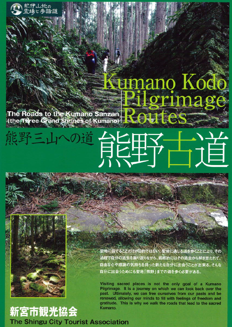
Chaque route de marche est inscrite et clairement expliquée avec la distance et le temps requis pour le parcours: La route Nakahechi, Kohechi, Ohechi de Kumano Kodo et la route Iseji.
PDF TéléchargerThe information of this brochure is dated as in 2016.
Information may differ from current ones.
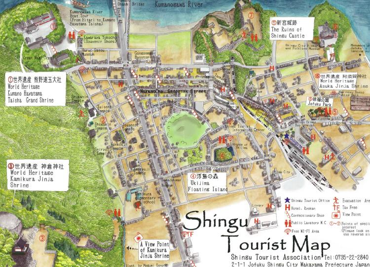
Carte de la ville au format A3. Outre les spots touristiques importants, vous y trouverez inscrits des informations sur les hébergements disponibles et leurs emplacements. Vous seront aussi présentés les spots Wi-Fi gratuits et les toilettes publiques. Les lieux touristiques sont détaillés sur le revers de la carte.
PDF TéléchargerThe information of this map is dated as in 2016.
Information of the shops may differ from current ones.
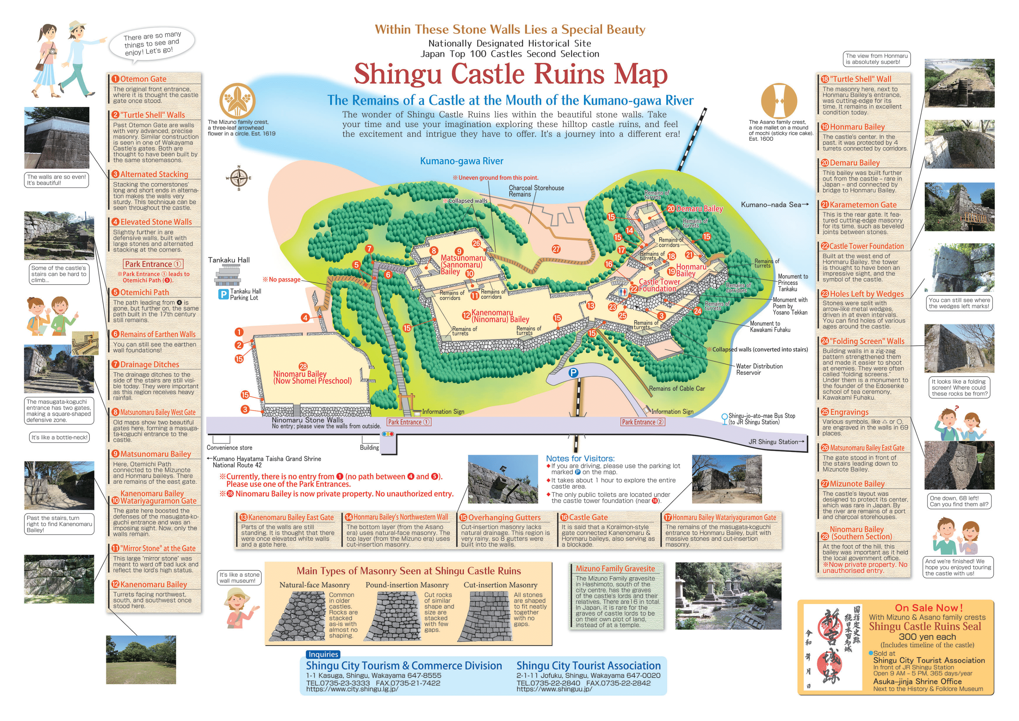
Carte des ruines du château de Shingu (aussi appelé «Tankaku-jo» ou «Château Tankaku») au format A3.
Télécharger le PDFLes informations de cette carte ont été actualisées en 2025.
Certaines informations peuvent être obsolètes.
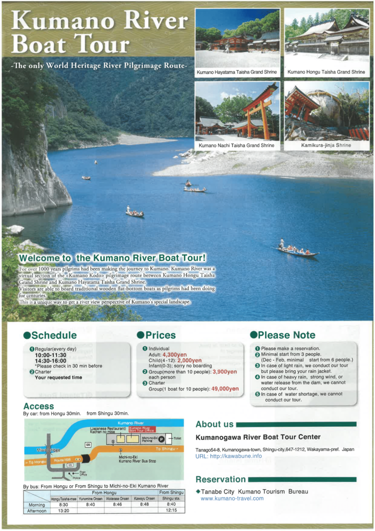
Un prospectus expliquant l’expérience de descente en chaloupe “Kawabune” du patrimoine mondial “la rivière Kumano-gawa, Section de Kumano Kodo”. Les différentes vues sont expliquées étape par étape.
PDF TéléchargerThe information of this map is dated as in 2019.
Information of the shops may differ from current ones.
Les routes de marche Nakahechi, Kohechi, Ohechi de Kumano Kodo et la route Iseji sont clairement expliquées, avec la distance et le temps requis pour le parcours.
PDF TéléchargerThe information of this map is dated as in 2016.
Information of the shops may differ from current ones.
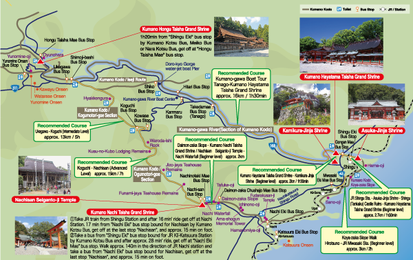
With Shingu as the starting point, we gathered transportation information for Kumano Hongu Taisha Grand Shrine and Kumano Nachi Taisha Grand Shrine together with a recommended course of Kumano Kodo in one map.
PDF TéléchargerThe information of this brochure is dated as in 2017, and may differ from the current ones.
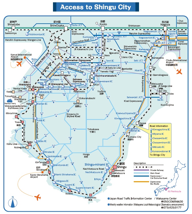
It is a map listing the major railroads (JR, private railway), road (highway, general road), air route of Kansai and Nagoya, metropolitan area and Shingu.
PDF TéléchargerThe information of this brochure is dated as in 2017, and may differ from the current ones.
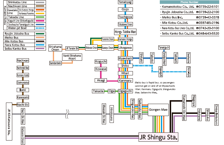
Major bus routes (route bus, airport limousine bus, long distance high speed bus) convenient for sightseeing around Shingu and the sightseeing cruise of the Kumano River are listed.
PDF TéléchargerThe information of this brochure is dated as in 2017, and may differ from the current ones.